

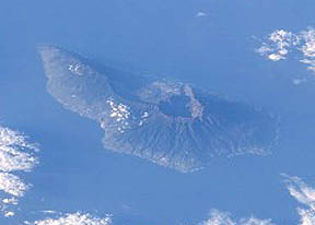
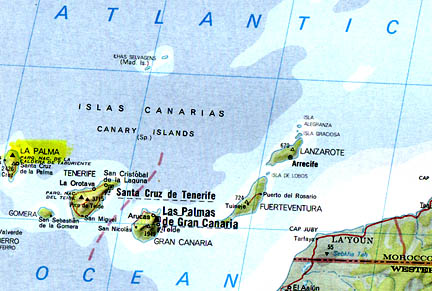
January 21, 2005 Santa Cruz, California - The seven Canary Islands owned by Spain rise above the Atlantic Ocean west of Morocco, Africa. One of them, La Palma, is not only the steepest island in the world, but has also been the most volcanically active of the Canaries in the past 500 years. On it is the 4-mile high volcano called Cumbre Vieja, which means "Old Summit." The volcano has been re-building itself for the past 15,000 years since it last blew apart and collapsed huge amounts of rock into the surrounding ocean, sending out a giant tsunami that has been detected in deposits as far away as the Bahamas and Bermuda. Over the past 15,000 years, the volcano kept erupting under water, building back up from the Atlantic sea bed three miles below the water surface to its present height, which is now more than a mile above the Atlantic. Its last two eruptions were 1971 and 1949.
© 1998 - 2025 by Linda Moulton Howe.
All Rights Reserved.