

"The physical data knocks out the chance that people hoaxed this. People just cannot hoax the expulsion cavities and they cannot elongate the growth nodes..."
- Jeffrey Wilson, ICCRA
Return to Part 1: U. S. Crop Formations in Epps, Louisiana, and Red Bluff, Calif.
Return to Part 2: U. S. Crop Formations, Two Mysterious Grass Circles in Mission, Kansas.
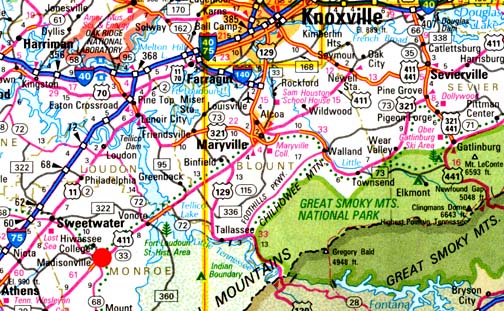
June 7, 2007 Williamsburg, Ohio - On May 24, 2007, I received a phone call from Jeffrey Wilson, Director of the Independent Crop Circle Research Association (ICCRA) in Williamsburg, Ohio, telling me that the Monroe County Buzz newspaper in Madisonville, Tennessee, had a headline about a crop formation in a wheat field. Madisonville, Monroe County, Tennessee - site of the historic Cherokee nation's capital, Chota - is straight south of the Oak Ridge National Laboratory outside Knoxville and west of the Great Smoky Mountains (red circle on map).
© 1998 - 2025 by Linda Moulton Howe.
All Rights Reserved.