Part 2: Windmill Hill and West Overton After Rains

“My eye was attracted toward Lockeridge about a mile north
of the formation. ‘Oh, my God, it's one of those aerial, flickering mirrors!’”

- Linda Moulton Howe, Reporter & Editor, Earthfiles.com


Rain was heavy in Wiltshire County, England, even flooding roads, the first week of August 2009. But at Windmill Hill near Avebury Trusloe, a 350-foot-diameter pattern of circles on rings with complex dumbbells in the center was reported on August 6. Aerial image © 2009 by Frank Laumen, VisibleSigns.de.   More information and images: Cropcircleconnector.com.
Upper left purple circle marks location of Windmill Hill near the ancient stones of Avebury. The lower right purple circle marks the location of West Overton near Lockeridge, both in the English county of Wiltshire.

Return to Part 1

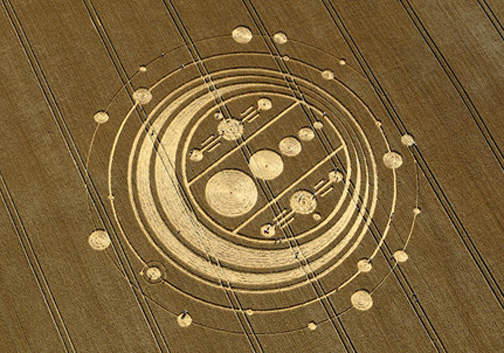
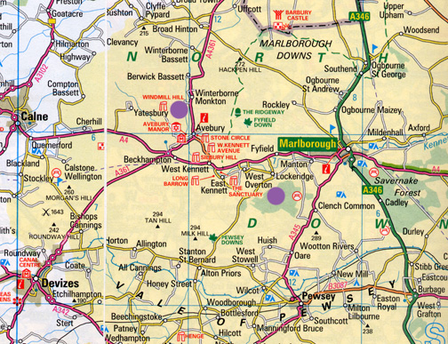
August 17, 2009  Albuquerque, New Mexico -  The morning of August 6, 2009, when I and others first went to the remarkable Windmill Hill formation, it was still raining after nights and days of rain. But the next day on August 7, 2009, the clouds lifted, sun came through and Charles Mallett took his 20-foot-pole and camera to the Windmill Hill pattern.


Click here to subscribe and get instant access to read this report.

Click here to check your existing subscription status.

Existing members, login below:


© 1998 - 2024 by Linda Moulton Howe.
All Rights Reserved.