

— “There's no cloud, there's nothing to produce a rain echo ... which we do see a lot, but not this particular S-shape.”
- Neil Bennett, Perth Bureau of Meteorology, Western Australia, February 12, 2014
— “The Unusual Pattern that appeared on the Bureau of Meteorology's Perth weather radar on Wednesday, February 12, was the result of a Defence exercise off the West Australian coast.”
- Australian Navy spokesperson, February 13, 2014
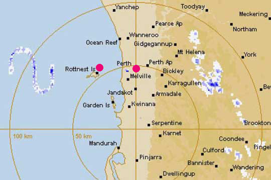
Updated February 17 / Original February 13, 2014 Perth, Australia - The Australian Broadcasting Corporation (ABC) reported on February 13, 2014, that “a strange S-shaped formation which appeared on Perth weather bureau radar off the West Australian coast on February 12, 2014, was not caused by cloud.” ABC News in Australia had inquired with the Australian Department of Defence about whether there are military operations off the west coast that might interfere with weather radar, but received no comment for some 24 hours. Then on February 13, an Australian Navy spokesperson released a statement to the general press that read in part:
© 1998 - 2026 by Linda Moulton Howe.
All Rights Reserved.