More Aerial “Milk Bottles” Photographed By Game Trail Cameras

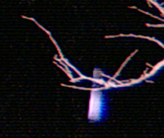
“These [ December 1, 2008] ‘milk bottle’ photographs, are unique because they show the object behind a tree branch. This finally settles the reflection/real object controversy; whatever it is, this new data clearly confirms it is a real object.”

- Chris Zietkiewicz, Ph.D., Senior Engineer

“Milk bottle” aerial object caught by game trail camera behind tree branch on December 1, 2008, between 11:05 PM and 11:29 PM Central in Edom, Texas. Image provided by camera owner.

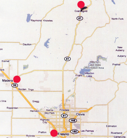
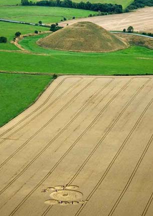
September 11, 2009  Edom, Texas -  A year and a half ago on April 7, 2008, I interviewed Bob Coine, President and Owner of Heartland Studios, Inc., in Oregon, Illinois. His company is devoted to protecting, improving and managing wildlife, with an emphasis on white tail deer. See:  040708 Earthfiles.

In order to keep track of how many white-tailed bucks and does use his farm and to estimate ages of the bucks, Bob explained that he uses a variety of game trail cameras. He has pure infrared cameras that do not flash and take images in non-visible infrared; standard 35mm cameras; and digital cameras that have an infrared beam to detect motion, which then triggers the camera to flash in the visible light spectrum. Six photographs taken in visible flash mode on November 16, 2007, beginning at 3:59 AM over a three minute time span, are still a mystery.


Click here to subscribe and get instant access to read this report.

Click here to check your existing subscription status.

Existing members, login below:

Authorities Baffled in California and Switzerland As Cattle Fall Off Cliffs and Die

“We are investigating because cows that grow up in the mountains normally can estimate dangers and do not plunge down cliffs.”

- Swiss Police Officer

September 8, 2009  Coarsegold, California, and Lauterbrunnen, Switzerland -

Coarsegold, California

Coarsegold is a ranching region north of Fresno, Madera County, California.

On August 14, 2009, more than thirty young males from a cattle herd were discovered dead in the Fresno River near Coarsegold, California, in Madera County. The owner of the animals is a rancher from Chowchilla, California, who did not talk to the media.


Click here to subscribe and get instant access to read this report.

Click here to check your existing subscription status.

Existing members, login below:

Part 6: Is Time Travel Past and Future Possible?

“There are actually several solutions of Einstein’s equations that allow for travel to the past and future through time and travel through space. ”

- Michio Kaku, Ph.D., Theoretical String Theory Physicist

If wormholes could be discovered, they might allow us to travel through hyperspace to the past as well as the future.

Return to Part 1

August 27, 2009   New York City, New York - Staff Sgt. Jim Penniston is not the only UFO experiencer who has linked UFOs to time travelers. That idea has also come from people in the human abduction syndrome who report missing time and encounters with non-humans. Is time travel past and future really possible?


Click here to subscribe and get instant access to read this report.

Click here to check your existing subscription status.

Existing members, login below:

Part 3:  Silbury Hill “Quetzlcoatl Headdress” First Filmed At Dawn

The reddish iris on the map marks the position of 5,000-year-old Silbury Hill that rises 130 feet above the land on the north side of the Roman Road. Across the road to the south, the topography rises to another hill nearly as high as Silbury Hill. The 350-foot-diameter “Quetzalcoatl Headdress” is marked by the green circle.


Return to Part 1

August 18, 2009  Albuquerque, New Mexico -  While I was in England July 24 to August 11, 2009, I met Ryan O'Hara, cameraman working with a documentary film crew that had been doing a night watch on top of 5,000-year-old Silbury Hill from 3 AM to dawn in the early morning hours of July 5. As the sunset turned to darkness on July 4th around 10 PM, no one amid all the air traffic over the ancient Avebury and Silbury complex had reported any new formation across the road from the 130-foot-tall Silbury Hill.


Click here to subscribe and get instant access to read this report.

Click here to check your existing subscription status.

Existing members, login below:

Part 2: Windmill Hill and West Overton After Rains

“My eye was attracted toward Lockeridge about a mile north of the formation. ‘Oh, my God, it's one of those aerial, flickering mirrors!’”

- Linda Moulton Howe, Reporter & Editor, Earthfiles.com


Rain was heavy in Wiltshire County, England, even flooding roads, the first week of August 2009. But at Windmill Hill near Avebury Trusloe, a 350-foot-diameter pattern of circles on rings with complex dumbbells in the center was reported on August 6. Aerial image © 2009 by Frank Laumen, VisibleSigns.de.   More information and images: Cropcircleconnector.com.
Upper left purple circle marks location of Windmill Hill near the ancient stones of Avebury. The lower right purple circle marks the location of West Overton near Lockeridge, both in the English county of Wiltshire.

Return to Part 1

August 17, 2009  Albuquerque, New Mexico -  The morning of August 6, 2009, when I and others first went to the remarkable Windmill Hill formation, it was still raining after nights and days of rain. But the next day on August 7, 2009, the clouds lifted, sun came through and Charles Mallett took his 20-foot-pole and camera to the Windmill Hill pattern.


Click here to subscribe and get instant access to read this report.

Click here to check your existing subscription status.

Existing members, login below:

Part 1: Windmill Hill Pattern Near Ancient Avebury Came in Rain

Rain was heavy in Wiltshire County, England, even flooding roads, the first week of August 2009. But at Windmill Hill near Avebury Trusloe, a 350-foot-diameter pattern of circles on rings with complex dumbbells in the center was reported on August 6. Aerial image © 2009 by Frank Laumen, VisibleSigns.de.   More information and images: Cropcircleconnector.com.

August 12, 2009  Albuquerque, New Mexico - I returned from England today with my photographs of the 350-foot-diameter formation at Windmill Hill near Avebury Trusloe in Wiltshire County. There was heavy rain in Wiltshire through nearly every day and night of late July and the first week of August. British newspapers reported that the unrelenting rain was delaying crop harvests in Wiltshire, Devon and other regions of England.


Click here to subscribe and get instant access to read this report.

Click here to check your existing subscription status.

Existing members, login below:

Extraordinary Details in New Silbury Hill Formation Destroyed by Farmer

 Above and below: Afternoon of Monday, August 3, 2009, was the first anyone knew that this new wheat pattern was near Silbury Hill. Aerial image © 2009 by Olivier Morel, WCCSG.
Above and below: Afternoon of Monday, August 3, 2009, was the first anyone knew that this new wheat pattern was near Silbury Hill. Aerial image © 2009 by Olivier Morel, WCCSG.

Silbury Aerial Olivier Morel 2


August 5, 2009 Yatesbury, Wiltshire, England - Mid-day on August 3, 2009, photographer and crop circle researcher Frank Laumen from Germany was driving on the road near Silbury Hill when through a gap in the trees, Frank could see something in a wheat field at the base that was definitely not there the night before when he and his German colleague, Andreas Mueller, had driven by after visiting the Morgan's Hill pattern reported August 2. Frank used his cell phone to call Andreas in another car behind him and they stopped to get into the field.


Click here to subscribe and get instant access to read this report.

Click here to check your existing subscription status.

Existing members, login below:

“Settlement” Wheat Formation Inside Ancient Celtic Settlement

Rectangular wheat “settlement” pattern within ancient Morgan's Hill Celtic settlement border reported August 2, 2009, at Morgan's Hill near Bishop Cannings. Aerial image © 2009 by Julian Gibsone. Other information and images: Cropcircleconnector.com.

August 3, 2009 Yatesbury, Wiltshire, England - Yesterday, August 2, 2009, a new wheat formation was reported at Morgan's Hill near Bishop Cannings, Wiltshire. This is the second pattern in 2009 around Morgan's Hill. The first was the “lunar cycle calculator” of April 24, 2009, in flowering oilseed rape that indicated a date of July 7, 2009, for an astronomical event that the Australian scientist and physicist Mike Reed of North Carolina reported might relate to a solar event, probably a flare. The largest sunspot in more than a year of our abnormally quiet, spotless sun occurred between July 5 and 7, 2009. So, that April 24th Morgan's Hill crop formation was forecasting a future astronomical event.


Click here to subscribe and get instant access to read this report.

Click here to check your existing subscription status.

Existing members, login below:

Silver Disc Videotaped Near Barbury Castle

“You can have 100 people in a park and this alien technology can control photons to such a point that only one person out of the hundred might see a craft right above their heads.”

- U. S. Intelligence Source


July 30, 2009  Yatesbury, Wiltshire, England - Being back in Wiltshire reminds me of the night back in the late 1990s when I was doing a live COAST report to Art Bell from a red English telephone booth in the countryside. With me were others who had joined me at the East Field silage pit for a night watch after a very rainy, stormy day. I had a powerful infrared scope that had been loaned to me by a former military friend - which was possible then before 9/11- and we had been looking into the dark mist over the East Field toward Golden Ball Hill to see if any mysterious lights might show up, since the small, glowing orbs have been seen before, during and after crop formations are created.


Click here to subscribe and get instant access to read this report.

Click here to check your existing subscription status.

Existing members, login below:

EARTHFILES