UPDATE: Death Toll in Australia Fires Now At Least 25 People and Half A Billion Animals.


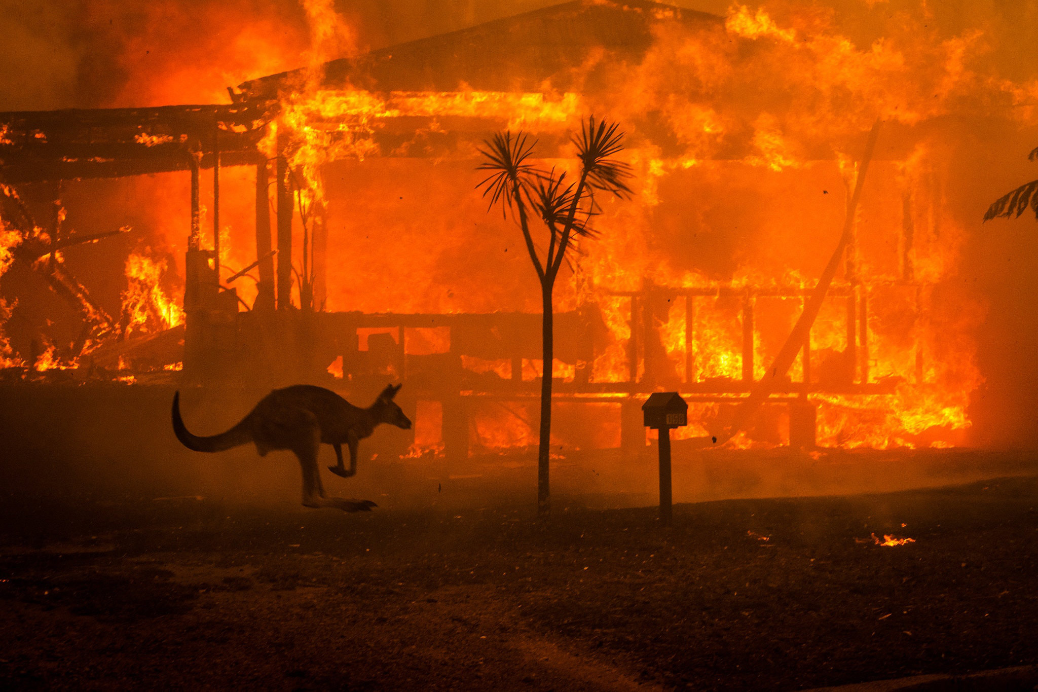
January 4, 2020: Penrith, Australia, Hit Record Breaking 120 Deg. F. on Jan. 4th, As 60,000 Square Miles Had Burned in Australia and the Death Toll of People Estimated At 20.

Channel 9 News, Sydney, Australia, January 4, 2020.
Saturday, January 4, 2020, was the hottest day on record in metropolitan Sydney, Australia, where 37 miles northwest the suburb of Penrith (map below) hit 120 degrees F., according to the Australian Bureau of Meteorology. The national capital, Canberra, set a record high with a temperature of 110 degrees F.
Saturday, January 4, 2020, was the hottest day on record in metropolitan Sydney, Australia, where 37 miles northwest the suburb of Penrith (map above) hit 120 degrees F., according to the Australian Bureau of Meteorology. The national capital, Canberra, set a record high with a temperature of 110 degrees F.


60,000 square miles (14.8 million acres) have burned up in Australia since November 1, 2019, and 20 people have died, including three volunteer firefighters. The weekend of January 4-5, 2020, is expected to be a "blast furnace," according to Andrew Constance, Transport Minister in New South Wales. Map assembled from NASA data by BBC as of January 3, 2020.
60,000 square miles (14.8 million acres) have burned up in Australia since November 1, 2019, and 20 people have died, including three volunteer firefighters. Map assembled from NASA data by BBC as of January 3, 2020.

“Southeastern Australia is going to be a blast furnace the weekend of January 4-5, 2020.”

— Andrew Constance, Transport Minister, New South Wales, Australia


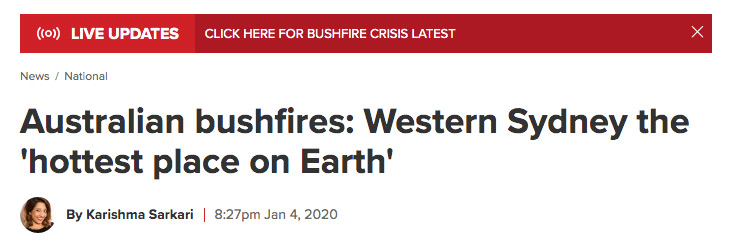
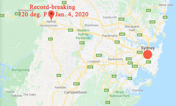
Update January 4, 2020 / January 3, 2020  Sydney, Australia – Saturday, January 4, 2020, was the hottest day on record in metropolitan Sydney, Australia, where 37 miles northwest the suburb of Penrith (map above) hit 120 degrees F., according to the Australian Bureau of Meteorology. The national capital, Canberra, set a record high with a temperature of 110 degrees F.

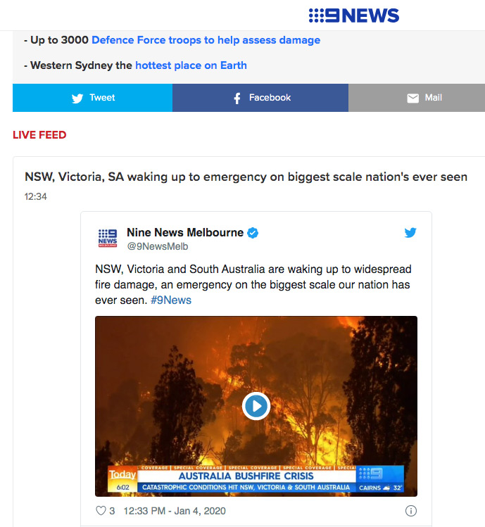
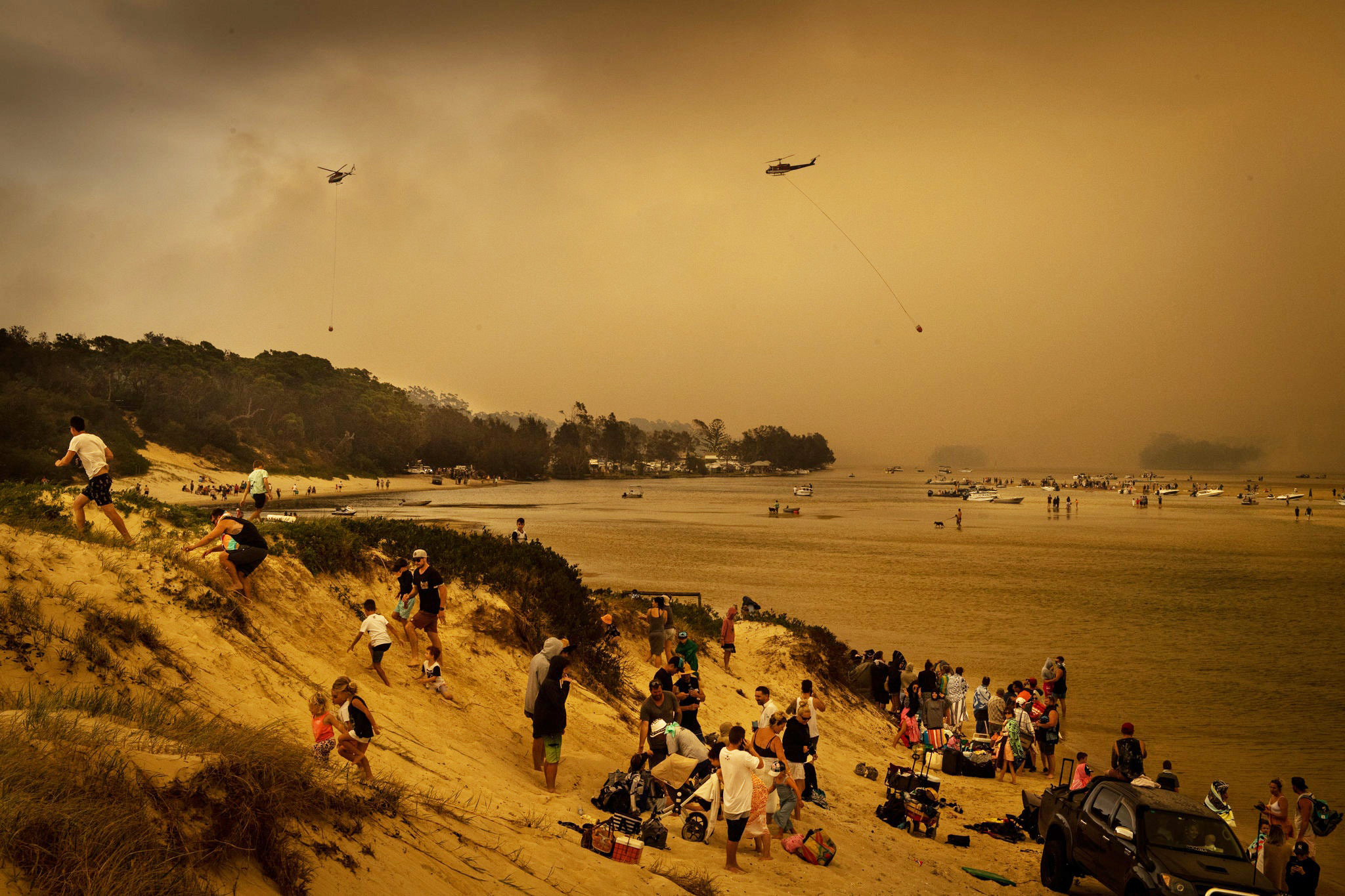
Those high temperatures and worst fires in Australian history are forcing thousands of people from homes. More than 1,000 people and 113 dogs reached Melbourne on Saturday after two Navy ships rescued them from New South Wales seaside towns ringed by fires in southeastern Australia.

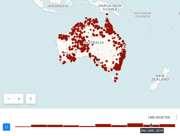
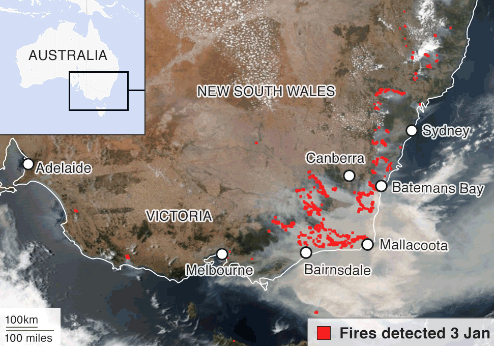
The day before on January 3, 2020, more than 130 fires were burning across NSW. Volunteer firefighters have put their lives on the line to at least contain many of the fires, but today more than 60 are still out of control, are a risk to animal and human lives as the weekend of January 4 – 5, 2020, is expected to be a “blast furnace,” according to Andrew Constance, Transport Minister in New South Wales.

The rural town of Balmoral southwest of Sydney in New South Wales was destroyed in catastrophic fires on December 22, 2019. Image © 2020 by BBC.
The rural town of Balmoral southwest of Sydney in New South Wales was destroyed by catastrophic fires on December 22, 2019. Image © by BBC.

Authorities in New South Wales have closed parks, trails and camping grounds and tourists have been told to urgently leave a 160-mile-long stretch of the NSW coast before the January 4-5, 2020, weekend as temperatures and fires are expected to be the most extreme to date.

The NSW beach town of Mallacoota, Australia, and other towns north and south had fires chasing residents and tourists to the beach where thousands of people waited to be rescued. Image by NSW Rural Fire Service.
The NSW beach town of Mallacoota, Australia, and other towns north and south had fires chasing residents and tourists to the beach where at least a thousand people waited to be rescued. Image by NSW Rural Fire Service.
This NASA satellite image shows fires in red spreading in New South Wales and Victoria on January 3, 2020. The smoke is so thick that it has reached New Zealand 1,300 miles away. Map by NASA and BBC.


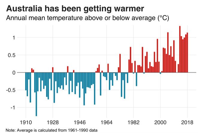
Height and Intensity of Flames Greater Than Normal As Australia Has Warmed Since 1980s

The NSW rural fire service and the BBC estimate now that the New South Wales fires since July 1, have burned at least 15,444 square miles (4 million hectares) compared to 3,475 square miles (900,000 hectares) in the 2019 Amazon raging fires and 3,088 square miles (800,000 hectares) in the 2018 California blazes. Firefighters also report that the new Australia flames have risen to at least 230 feet high (70 m), higher than the Sydney Opera House that is 213 feet high (65 m).

Out-of-control huge flames 230 feet (70 m) high on the northern edge of the Blue Mountains national park in Australia. Video image on Dec. 16, 2019, by Mehr News Agency.

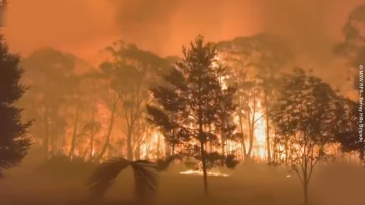
The Australian Bureau of Meteorology reports that Australia has been getting warmer and warmer since the 1980s.

Celsius mean temperatures averages calculated from 1961 to 1990 temperature data by Australia's Bureau of Meteorology. In the Celsius scale there are 100 degrees between the freezing point and the boiling point of water compared to 180 degrees in the Fahrenheit scale. This means that 1 °C = 1.8 °F.
Celsius mean temperature averages calculated from 1961 to 1990  data by Australia’s Bureau of Meteorology. In the Celsius scale there are 100 degrees between the freezing point and the boiling point of water compared to 180 degrees in the Fahrenheit scale. This means that 1 °C = 1.8 °F.

More Information:

09-26-2019 – Why Are So Many Earth Insects Dying?
08-30-2018 – Why Are 2018 Wildfires So Ferocious?
09-29-2017 – Storms Keep Getting Stronger With More and More Water
03-30-2017 – 93% of Australia’s Great Barrier Reef Suffering Coral Bleaching.


Websites:

Jan. 2, 2020 Satellite View of Australian Fires: The Himawari-8 satellite’s view of the Australian bushfires and smoke clouds: http://rammb.cira.colostate.edu/ramsdis/online/images/hi_res/himawari-8/full_disk_ahi_true_color/full_disk_ahi_true_color_20200101022000.jpg

“Ferocious Fires in Australia Intensify,” NASA:  https://www.nasa.gov/image-feature/goddard/2020/ferocious-fires-in-australia-intensify

Australia Bureau of Meteorology:  http://www.bom.gov.au


© 1998 - 2024 by Linda Moulton Howe.
All Rights Reserved.