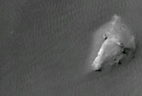
“Since we know that the Google Mars image is older, and of higher resolution than the fake Photoshopped image, then perhaps as it got closer to the Curiosity Landing date, and the Mars Orbiter was used to take more photos of the Curiosity landing zone ... perhaps NASA saw something that hadn’t been in earlier photos ... and needed to be covered up.”
- Retired U. S. Navy Captain
“I find it interesting that in Google Earth->Mars, there are two high-resolution image strips of the Curiosity landing area with a big gap between them, and that whatever they're hiding falls in that gap.”
- Daniel
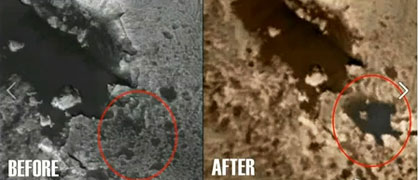
Editorial Note: The word "lake" in quotation marks is used throughout this Earthfiles report to denote the darker, lake-like patterns, but does not literally mean liquid water, which cannot last long on the surface of Mars without sublimating into the atmosphere. Speculation is that the darker colored patterns that resemble lakes are mineral residues that are currently unidentified on what appear to be the bottoms of ancient lake beds.
Updated September 24, 2012 Albuquerque, New Mexico - On September 21, I received an email with the following YouTube URL posted on September 19, 2012, by “SunsFlare.” I was asked to view what was described as deliberately faked Gale Crater images on Mars. Gale Crater is where the Curiosity Mars Science Lab rover landed on August 5, 2012, at 10:31 PM Pacific to explore for evidence of water and chemistry of life on the Red Planet.