When America’s 37th Coast Artillery Brigade fired off 1,430 anti-aircraft shells at a diamond-shaped craft of unknown origin.
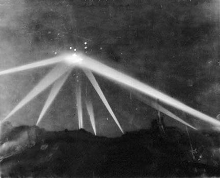
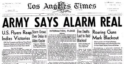
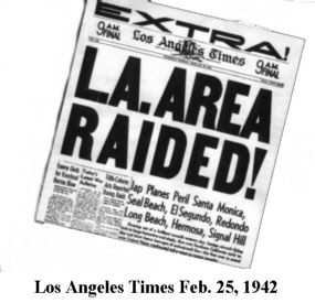
April 14, 2005 Los Angeles, California – Sixty three years ago on February 24-25, 1942, all of southern California from the San Joaquin Valley to the Mexico border was blacked out. Fearing a WWII Japanese invasion attack after Pearl Harbor on December 7, 1941, air raid sirens had gone on and off the evening of February 24, as intermittent unidentified aerial lights were reported. Then at 2:25 a.m. on February 25, most of the greater Los Angeles region’s three million population was awakened by loud air raid sirens that kept wailing for the next thirty-eight minutes. Powerful searchlights were aimed at a glowing unidentified aerial object over the Santa Monica Mountains that was shaped like a “lozenge.” Then America’s 37th Coast Artillery Brigade fired off 1,430 anti-aircraft shells at the unidentified aerial, diamond-shaped craft.Click for report.