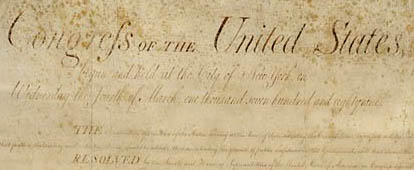
Sixth Straight Year Hundreds of Birds Die at Roestler Lake, North Dakota

Left: Young Double-Crested Cormorant. Middle: Ring-Billed Gull. Right: Adult Double-Crested Cormorant. Photographs courtesy U. S. Geological Survey National Wildlife Center.


For the sixth straight year, hundreds of ring-billed gulls and cormorants have died in the Roestler Lake Waterfowl Protection Area in Logan and McIntosh Counties of North Dakota south of where 29,000 pelicans disappeared from the Chase Lake National Wildlife Refuge in mid-June 2004.

Click for report.

Crop Circles in Tilden, Wisconsin Oats and 90-Degree Angles in Litchfield, Minnesota Barley

Northwest of Minneapolis in Litchfield, Minnesota, 6.2 square miles of barley had many sections randomly laid down in 90-degree angles to each other, discovered on July 4, 2004. Two weeks later on July 19, 2004, east of Minneapolis in Chippewa Falls, Wisconsin, three large circles connected by pathways were reported in oats.

July 26, 2004  Eau Claire, Wisconsin – I talked with Terry Fisk, an Eau Claire, Wisconsin, electric power company employee whose hobby is to investigate crop formations with his colleague, Chad Lewis. On Monday, July 19, 2004, Chad received an e-mail from someone called “Adam Prince.” The short e-mail said there was a crop circle just outside Chippewa Falls, Wisconsin, and gave directions. Chad was working, but Terry drove out to see if he could find the field and formation.

Click for report.

2004 Canadian Crop Formations: Scorched Soybeans and “Dirt” Pattern in Barley

July 25, 2004  Vancouver, British Columbia, CanadaI talked this week with Paul Anderson, Director of Canadian Crop Circle Research Network (CCCRN) in Vancouver. The crop circle season so far has brought four patterns which began with a simple ring in pasture grass on June 24, 2004, near a small town called Erb’s Cove in New Brunswick. Over the past decade, New Brunswick has had reports of very few crop formations in contrast to Saskatchewan and Alberta which have had the most. From Paul’s research of Canadian history of the phenomenon, he has found 233 reports between 1925 and 2004. Saskatchewan is the center of activity, “sort of like Wiltshire is in England,” he says.

First Canadian formation of 2004 reported on June 24, near small town of Erb's Cove in New Brunswick, Canada, between Maine on the west and Nova Scotia on the east.
First Canadian formation of 2004 reported on June 24, near small town of Erb’s Cove in New Brunswick, Canada, between Maine on the west and Nova Scotia on the east.

Click for report.

What’s Happening to Birds? – More Reports

July 24, 2004 – Last night on Coast to Coast AM radio, I reported about the earth’s weakening magnetic field and the many reports I receive about large populations of birds disappearing or even dying. I also asked the Earthfiles and radio audience to let me know about bird anomalies. I have received so many reports today that I am sharing some of them from various regions of the country.

E-mail # 1 – Lusk, Wyoming: 

“I recently moved back to Wyoming after a 30-year stint in California. One of the first things I noticed was the lack of birds here. The state bird is the Meadowlark and I have always loved listening to them. They are gone.Click for report.

Crop Formations and Mysterious Lights in Wiltshire, England, July 2004

See: Part 1

July 23, 2004 Wiltshire, England – Between July 11 and July 23, 2004, sixteen crop formations have been reported in southern England, the majority in the country of Wiltshire which has been the heart of the modern British phenomenon since at least the late 1980s. To keep up with news about English crop formations, see Cropcircleconnector.com and other websites included in the final segment of this report.

Click for report.

Earth’s Weakening Magnetic Field – Signal of Pole Reversal?

“A reversal could knock out power grids, hurt astronauts and satellites, widen atmospheric ozone holes, send polar auroras flashing to the equator and confuse birds, fish and migratory animals that rely on the steadiness of the magnetic field as a navigation aid.”

– The New York Times, July 13, 2004

A graphical representation of the total magnetic field strength at the Earth's surface inferred from the latest International Geomagnetic Reference Field, the IGRF2000, valid until 2005. The red-to-yellow colors indicate a field strength below the mean Earth's total magnetic field strength. The blue-to-black range represents a field strength above the mean field at the surface. The most pronounced minimum field strength is found in South America and in the South Atlantic below South Africa. Graphic produced from Danish Orsted satellite which measures Earth's geomagnetic fields.
A graphical representation of the total magnetic field strength at the Earth’s surface inferred from the latest International Geomagnetic Reference Field, the IGRF2000, valid until 2005. The red-to-yellow colors indicate a field strength below the mean Earth’s total magnetic field strength. The blue-to-black range represents a field strength above the mean field at the surface. The most pronounced minimum field strength is found in South America and in the South Atlantic below South Africa. Graphic produced from Danish Orsted satellite which measures Earth’s geomagnetic fields.

July 23, 2004 Santa Cruz, California – Magnetic field lines have been coming out of the south pole and entering the north pole of the earth for the past 780,000 years. That is called the magnetic dipole. But now scientists have been monitoring the strongest change humans have ever recorded in the magnetic field at the surface of the earth’s internal iron core four thousand miles down. The result, according to French geophysicist Gauthier Hulot, is that the South Atlantic below Africa and South America now have a magnetic field that is 30% weaker than the rest of the planet. Already some satellites passing over that weak magnetic field have suffered electronic failures because charged particles from the sun can penetrate more easily in a weak magnetic field. And over the past century, the global magnetic field has weakened about 10 to 15 percent. Recently, that magnetic field deterioration has accelerated, provoking scientists to wonder if it will build up to a pole reversal in which compasses will point to the south instead of the north.Click for report.

What Is Happening to Birds? Updated With Viewer Reports

Homing pigeons navigate by the sun and the earth's magnetic fields. Photograph © Acclaim Images.
Homing pigeons navigate by the sun and the earth’s magnetic fields. Photograph © Acclaim Images.


July 22, 2004 Stockholm, Sweden – Lloyd Jones reporting for Australia’s Herald Sun in Stockholm began a dispatch today:

“Homing pigeons vanish during race. Organizers of a race for homing pigeons were still scratching their heads in wonder today after about 1500 of the birds, famous for their ability to find their way home, went missing during the contest.”

Usually it takes the pigeons only two hours to return to their home lofts. But a member of the Malmoe Homing Pigeon Club, Lars-Aake Nilsson, said only about 500 of the 2000 pigeons flown in the contest have returned after the 150 kilometer flight between the cities of Ljungby and Malmoe in southern Sweden. “Click for report.

Inside Job – Unmasking the 9/11 Conspiracies by Jim Marrs

“There is also the fact that NOAD-Northeast was conducting war game exercises that morning, a fact that has been very little talked about and certainly not reported to the general public. What’s also not been reported, according to the information that I have, at least one of the scenarios they were considering in their war game exercises concerned hijacked aircraft being crashed into buildings. Now, this could explain the lack of response when the air traffic controllers began to report that four planes were off course…”

– Jim Marrs, Author, Inside Job

For new book © July 2004 by Jim Marrs, click on cover to order.
For new book © July 2004 by Jim Marrs, Inside Job: Unmasking the 9/11 Conspiracies

 July 17, 2004  Wise County, Texas – Jim Marrs has been tracking down facts and trying to make sense of political stories in America since his college days as a journalism major at North Texas University in Denton. He graduated in 1966 and began a newspaper reporting and editing career at the Denton Record Chronicle, Lubbock Avalanche Journal and Fortworth-Star Telegram where he was an investigative reporter and cartoonist, and earned photography awards.Click for report.

Updated: Part 1 Beyond Hillsboro, Ohio, More Corn Down in New Milford, Connecticut


Left: Randomly downed corn discovered July 5, 2004, in Hillsboro, Ohio garden. Photograph © 2004 by owners. Right: Discovered July 13, 2004, more of a rectangle of downed corn about 40 feet long by 30 feet wide in Martha Bailey's garden, New Milford, Connecticut. Photograph © 2004 by David W. Harple, The New-Times.
Left: Randomly downed corn discovered July 5, 2004, in Hillsboro, Ohio garden. Photograph © 2004 by owners. Right: Discovered July 13, 2004, more of a rectangle of downed corn about 40 feet long by 30 feet wide in Martha Bailey’s garden, New Milford, Connecticut. Photograph © 2004 by David W. Harple, The New-Times.

     New Milford is about twenty miles west of Waterbury, Connecticut.

New Milford is about twenty miles west of Waterbury, Connecticut.July 15, 2004  New Milford, Connecticut – Yesterday, Kamilla Gary reported in The News-Times of Danbury and New Milford, Connecticut, about “Mystery of the maize: New Milford woman’s corn crop flattened overnight. Mid-garden damage defies explanation, son says.”Today I talked with Kamilla and the corn crop’s owner, Martha Bailey, who has lived at her New Milford home for three years. There is a 7-foot wire fence built around her garden of tomatoes, squash, yellow and white corn. The squash was about three feet high and the corn plants were nearly six feet high. But on Tuesday morning at 6 a.m., she had sat down to have coffee and was shocked when she looked out the window.Click for report.

Updates on Spanish Fork, Utah Barley Formation

Twenty-three feet to the east of the large central ring (small circle with standing crop nearest Chopper 5 logo), an "eyeball" addition was discovered on Sunday, July 4, 2004, after a local Spanish Fork, Utah, family reported seeing small white lights moving in that same area after 11 p.m. MST on Saturday, July 3, 2004. Aerial photograph © 2004 by Channel 5 KSL-TV, Salt Lake City, used with permission.
Twenty-three feet to the east of the large central ring (small circle with standing crop nearest Chopper 5 logo), an “eyeball” addition was discovered on Sunday, July 4, 2004, after a local Spanish Fork, Utah, family reported seeing small white lights moving in that same area after 11 p.m. MST on Saturday, July 3, 2004. Aerial photograph © 2004 by Channel 5 KSL-TV, Salt Lake City, used with permission.
The July 3 to July 4, 2004, Saturday night to Sunday "eyeball" addition is shown 23 feet to the east of the main large and original ring in the barley formation first discovered by the farm owners on June 26, 2004. After the July 4, 2004 addition, the overall formation measured 207 feet in length and 118 feet in width. Diagram © June 30, 2004 by Melissa Crumpton.
The July 3 to July 4, 2004, Saturday night to Sunday “eyeball” addition is shown 23 feet to the east of the main large and original ring in the barley formation first discovered by the farm owners on June 26, 2004. After the July 4, 2004 addition, the overall formation measured 207 feet in length and 118 feet in width. Diagram © June 30, 2004 by Melissa Crumpton.


July 13, 2004  Spanish Fork, Utah – Since my July 6, 2004 Earthfiles report about an addition to the Spanish Fork, Utah barley formation associated with the presence of mysterious small lights, I have talked with Channel 5 KSL television in Salt Lake City about returning to do a second aerial. KSL’s first aerial taken before July 1 is shown below. Today, KSL provided the new aerial image above which was videotaped on Tuesday, July 6, 2004. Spanish Fork resident Melissa Crumpton, a field worker for BLT Research which sampled plants and soil, also did a diagram of the formation after the July 4 addition. The overall pattern measured 207 feet in length and 118 feet in width.Click for report.

Earthfiles