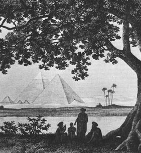
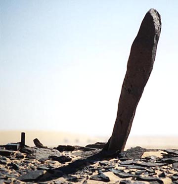
Another Solar System Like Ours?


This graphic depiction compares our solar system with a newfound planetary system, 55 Cancri. The new system has a larger-than-Jupiter-mass planet in an orbit similar to the orbit of our Jupiter. Another large gaseous planet orbits closer to 55 Cancri. Image courtesy NASA and JPL.

June 14, 2002  Pasadena, California - Today NASA's Jet Propulsion Laboratory announced that astronomers have discovered another solar system orbiting around the star 55 Cancri in the constellation Cancer which resembles our own sun and planets, at least in two large gaseous planets located at similar orbit distances. The first planet there was discovered in 1996 near that sun. The star 55 Cancri is 41 light years from Earth and is about the same age as our solar system, 5 billion years.


Click here to subscribe and get instant access to read this report.

Click here to check your existing subscription status.

Existing members, login below:

Update About Cuba Underwater Megalithic Research

A half mile down in the waters of Cabo de San Antonio off the western tip of Cuba's Guanahacabibes marked by red X is a 20-kilometer square area of clean, white sand punctuated by tall, megalithic stones or structures  first reported in May 2001 by Paulina Zelitsky, Ocean Engineer, Havana, Cuba.
A half mile down in the waters of Cabo de San Antonio off the western tip of Cuba's Guanahacabibes marked by red X is a 20-kilometer square area of clean, white sand punctuated by tall, megalithic stones or structures first reported in May 2001 by Paulina Zelitsky, Ocean Engineer, Havana, Cuba.

"They (megalithic stones) are very unique structures. They really are not easy to understand and I do not have any easy explanation for them in a natural geological process."

­ Manuel Iturralde-Vinent, Ph.D., Geologist,
National Museum of Natural History, Havana, Cuba


July 10, 2002  Havana, Cuba ­ A year ago in May 2001, I first reported at Earthfiles.com the startling comments made by ocean engineer, Paulina Zelitsky in Havana, Cuba about her finding earlier in 2000 "possibly a sunken city built in the pre-classic period and populated by an advanced civilization similar to the early Teotihuacan culture of Yucatan. ...Researchers using sonar equipment have discovered at a depth of about 2,200 feet (700-800 meters) a huge land plateau with clear images of what appears to be urban development partly covered by sand. From above, the shapes resemble pyramids, roads and buildings." (See Earthfiles May 18, 2001.)


Click here to subscribe and get instant access to read this report.

Click here to check your existing subscription status.

Existing members, login below:

Could Asian Nuclear War Radioactivity Reach North America?


 Red arrow points at India and Pakistan on opposite side of the world from Canada and the United States. The Marshall Islands where the U. S. experimented in the 1950s with many atomic tests is at the far left in the Pacific Ocean. From Marshall Island and Nevada Test Site nuclear explosions, radioactive fallout riding on the prevailing westerly winds reached North Carolina and New York, distances nearly equivalent to the 10,000 to 12,000 miles India and Pakistan are from the west coast of the United States.
Red arrow points at India and Pakistan on opposite side of the world from Canada and the United States. The Marshall Islands where the U. S. experimented in the 1950s with many atomic tests is at the far left in the Pacific Ocean. From Marshall Island and Nevada Test Site nuclear explosions, radioactive fallout riding on the prevailing westerly winds reached North Carolina and New York, distances nearly equivalent to the 10,000 to 12,000 miles India and Pakistan are from the west coast of the United States.

June 4, 2002  Tacoma Park, Maryland - If India and Pakistan strike each other with Hiroshima-sized bombs, how much radioactivity could reach the atmosphere and fall out around the world? That is a question I began asking a week ago and discovered that very little is known about the consequences downwind of such a catastrophe. The National Atmospheric Release Advisory Center (NARAC) at Lawrence Livermore National Laboratory in Livermore, California seemed like it should know. NARAC's public affairs office describes its "primary function is to support the Department of Energy (DOE) and the Department of Defense (DOD) for radiological releases." But when I asked an information officer there for information about the spread of radioactivity in the atmosphere from a nuclear war in Asia, the answer was, "That information is classified in the interests of national security."


Click here to subscribe and get instant access to read this report.

Click here to check your existing subscription status.

Existing members, login below:

New 2002 Crop Formations in Wiltshire and Sussex, England

Three formations have now appeared in Wiltshire, England near the famous stone circles of Avebury and Europe's largest artificial mound, Silbury Hill. Many formations have appeared in the same geographic places since 1990, sometimes in the exact position of previous years.


June 4, 2002  Avebury Trusloe, Wiltshire, England - For days prior to Saturday, June 1, rain had been falling hard on the crops in the famous farm county of Wiltshire, England. Then between the night of June 1 and 6 a.m. June 2, something touched young, green, 4-foot-high barley growing in a field near the famous and ancient ring of large sarsen granite stones in Avebury. The farm owner, a Mr. Butler, said he knew the barley was normal the day of June 1, so he was surprised and amazed to find a 180-foot-diameter formation of most intricate design at 6 a.m. on Sunday morning. According to Mr. Butler and a couple of other people who came along, the pattern was in pristine condition. No one could find tracks or other evidence of entry in the wet, rain-soaked mud.On June 2nd, Charles Mallett - new owner with his wife, Frances, of the Silent Circle Cafe in Cherhill not far from Avebury - heard about the new formation and went to see it. Charles has been in dozens of crop patterns and later talked with me by phone about his impressions.


Click here to subscribe and get instant access to read this report.

Click here to check your existing subscription status.

Existing members, login below:

EPA Admits Humans Burning Fossil Fuels A Big Factor in Global Warming

June 3, 2002, The New York Times front page.

June 3, 2002 Boulder, Colorado - Today the Bush Administration and its Environmental Protection Agency made the front page of The New York Times above the fold with an admission that human burning of fossil fuels is largely responsible for increasing greenhouse gases around the earth and global warming. Times reporter, Andrew Revkin, based his report on a 268-page document quietly submitted earlier this spring by the EPA to the United Nations entitled, "U. S. Climate Action Report - 2002, the Third National Communication of the United States of America Under the United Nations Framework Convention on Climate Change." In that agreement with the U. N., the United States is honor bound to report every five years on the progress this county is making on environmental issues. Reporter Revkin said the EPA report "strongly concludes that no matter what is done to cut emissions in the future, nothing can be done about the environmental consequences of several decades' worth of carbon dioxide and other heat-trapping gases already in the atmosphere.


Click here to subscribe and get instant access to read this report.

Click here to check your existing subscription status.

Existing members, login below:

Scientists Surprised by Abundance of Water Ice on Mars

Mars, the fourth planet from the sun, showing its white icy poles of both carbon dioxide frost and some water ice in contrast with the rusty red, desert surface over the rest of the planet. Photographed by the Hubble Space Telescope.
Layered, dusty Martian surface in far west Candor Chasma of the Valles Marineris, the largest canyon in the solar system. Photo courtesy NASA/JPL/MalinSpaceScienceSystems.

June 1, 2002  Pasadena, California - Since NASA's 1976 Viking missions, Mars has been thought by most people to be dry, dusty and dead, marked with ancient river channels and gullies that meant water had been there once upon a time. For several decades, traces of atmospheric water and some water ice along with frozen carbon dioxide at the poles had been known. But where had all the water gone that had once flowed through the rivers and canyons? Apparently, the oxidized, rusty surface has been deceiving. Less than a meter below the red rocks and dust in very cold regions, scientists have found a signal for the element hydrogen that is so strong it's assumed to be frozen H2O (water), according to this week's journal Science.


Click here to subscribe and get instant access to read this report.

Click here to check your existing subscription status.

Existing members, login below:

Part 1 – U. S. Nuclear Power Plants On Heightened Alert After Nuclear Regulatory Commission Warning


103 nuclear power plants in the United States above supply about twenty percent of the natin's electricity. Some states such as Kansas have only one reactor. Others such as Pennsylvania have nine reactors, including Three Mile Island which is near the Harrisburg International Airport. Graphic © 2001 by the Nuclear Regulatory Commission.

May 25, 2002  Washington, D. C. - This Memorial Day weekend, the U. S. government has announced several terrorist threat warnings. The latest came from the Nuclear Regulatory Commission placing all 103 nuclear power plants throughout the country on a heightened state of alert. This weekend the FBI also warned of possible underwater terrorist attacks by scuba divers that could target nuclear power plants as well. Recently intelligence sources warned that on the Fourth of July, Pennsylvania's Three Mile Island (TMI) could be the target of an Al Qaeda attack. In fact, there is concern that spent radioactive fuel could be stolen to produce a dirty bomb to be set off at nuclear power plants.


Click here to subscribe and get instant access to read this report.

Click here to check your existing subscription status.

Existing members, login below:

Earthfiles