Rapid Increase of Greenhouse Carbon Dioxide in 2003-2004

October 13, 2004  Tromso, Norway – Today in London at the annual Greenpeace business lecture, disturbing recent greenhouse data from America’s Mauna Loa Observatory in Hawaii, Britain’s Hadley Center and the Norwegian Institute for Air Research will be discussed. In 2002 and 2003, the average rise in the amount of CO2 in the Earth’s atmosphere rose from about 1.5 parts per million by volume to as much as 2.54 ppm. Some atmospheric scientists worry that such a sudden and rapid increase in greenhouse CO2 is linked to rising global temperatures. If the CO2 continues to increase rapidly for the next five to ten years, it could mean that even the soil of our planet is warming to the point that it more easily releases carbon dioxide to the atmosphere. Click for report.

Is NRC Making Terrorist Work Easier? Radioactive Material Sites On U. S. Government Website

“The Nuclear Regulatory commission (NRC) tracks radioactive materials at more than 21,000 sites through routine applications for license renewals that those sites must file with the government (NRC). …Documents for one well-known Northeastern university included a floor plan of the building showing the office and vault where the (radioactive) materials are kept.”

– The Patriot-News, October 3, 2004

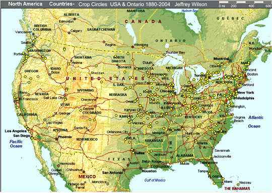
October 6, 2004  Harrisburg, Pennsylvania – Today the State Department offered a $5 million reward for Al Qaeda leader, Adnan El Shukrijumah, who last year allegedly posed as a student at McMaster University in Hamilton, Ontario, Canada, in an effort to steal radioactive materials from the university’s five-megawatt nuclear research reactor. The terrorist’s goal: to cause another “9/11” by constructing and blowing up a dirty radioactive bomb in the United States. American authorities also think El Shukrijumah directed Al Qaeda surveillance efforts of the financial districts in New York City, Washington, D. C., and Newark, New Jersey this summer that provoked Homeland Security to increase terror alerts for those cities to Code Orange. Click for report.

Earthquake Swarms At Mt. St. Helens, Washington

“Where we are now (September 27) is that the largest earthquakes are just a little bit below magnitude 2. They are still occurring at a pretty good clip of 1 or 2 per minute and it’s basically been in a holding pattern over the last twelve hours.”

– Seth Moran, Ph.D., USGS Seismologist, Vancouver, WA.

Mt. St. Helens has averaged an eruption every 100 years or so. The last big one above was May 18, 1980. The current earthquake swarms could be building up to steam release. Image © 1980 by Austin Post.

September 27, 2004 Vancouver, Washington –


Interview:

Seth Moran, Ph.D., Seismologist, U. S. Geological Survey, Vancouver, Washington: “On Wednesday, September 21, 2004, we started seeing more earthquakes than we usually see at Mount St. Helens. We usually see maybe one a day. Wednesday, there was a notable increase. Then running through Thursday, September 22, we started seeing a lot of earthquakes occurring maybe one a minute. They were all very small, very shallow, and after awhile, the seismicity rate declined and on Friday, kind of went down and looked like it was going away.Click for report.

Updated: Part 1 – High Strangeness in Canadian Cattle Corn

September 17, 2004  Vancouver, B. C. Canada – Canada has reported crop formations since the mid-1990s all over the provinces ­ but the region that has always had the most patterns for whatever reason has been Saskatchewan. Until 2004.

Currently, Paul Anderson, Director of the Canadian Crop Circle Research Network – known as CCCRN – has a total of twelve crop formations reported in eleven sites, starting on on May 26, 2004, at Nahanni Butte, Northwest Territories.Click for report.

Part 2: “Clearview” Report on the Investigation of UFO Experiences on A Rocky Mountain Ranch

Click to Part 1

“4. First Mutilation

Jim: Shortly after that, the oldest boy, Joe, had his friends out from Denver. They were out going through the woods ­ this was a Sunday morning ­ and they found our first mutilated cow about 200 yards from the house up over the hill. They came back in a panic. They were both 16-years-old. It was snowing heavily and we decided the first thing to do was get into town and get the law officer. The boys were pretty upset and we took some time to talk to them because they felt that something was following them to get them. I assumed it was a natural paranoia.We went out and I followed the route and we found huge footprints that had followed them all the way from the cow to the horse barn and the footprints were even in the soft manure inside the horse barn. They were, I guess, 18 inches long. I didn’t measure them, but they were quite large ­ what you would call a ‘big foot’ footprint.Click for report.

Update on Miamisburg, Ohio, Corn Pictogram – Balls of Light?

Miamisburg, Ohio, and its famous mound are fifty miles northwest of Hillsboro, which is also in the Hopewell ancient mound region. In 2003, there were several complex crop formations in soybeans in the mound region east and south of Hillsboro. See 09-06-03 Earthfiles.
Large pictogram measured 220 feet in 8-foot-tall Miamisburg, Ohio, corn field reported September 1, 2004. See 09-02-04 Earthfiles. Aerial photograph © 2004 by Jeffrey Wilson.


September 8, 2004  Miamisburg, Ohio – On September 2, 2004, at 9 p.m. Eastern Time, Jeffrey Wilson called me on his cell phone while standing in the middle of “the most impressive corn formation” he has ever seen. Jeff, based in Cincinnati, Ohio, is Director of the Independent Crop Circle Researchers Association (ICCRA). With him was colleague Ted Robertson, (B.S. Biology, Indiana University) from Ellettsville, Indiana, who makes detailed diagrams of crop formations and who was taking photographs at the time Jeff was talking with me on the phone.Click for report.

Part 2 – Hillsboro, Ohio Corn Plant Anomalies

Hillsboro, Ohio is near the Hopewell ancient mound region where in 2003, there were several complex crop formations in soybeans noted by yellow in the above map. See 09-06-03 Earthfiles.

September 5, 2004  Cincinnati, Ohio – Continuing interview with Jeffrey Wilson, Director, Independent Crop Circle Researchers Association (ICCRA), Cincinnati, Ohio:

“HILLSBORO IS ANOTHER EXAMPLE IN WHICH THE PLANTS WERE LAID ALL IN ONE DIRECTION. COULD YOU SUMMARIZE AGAIN THE LIST OF ANOMALIES YOU’VE FOUND?Click for report.

Hillsboro, Ohio Corn Formation – High Strangeness in Soil and Plants

Hillsboro, Ohio is near the Hopewell ancient mound region where in 2003, there were several complex crop formations in soybeans noted by yellow in the above map. See 09-06-03 Earthfiles.

September 4, 2004  Cincinnati, Ohio – So far in 2004, there have been 17 crop formations reported in the United States ­ beginning on May 26th with a 7-fold (wagon wheel) geometric wheat pattern in Peach Orchard, Arkansas (See 06-02-04 Earthfiles); followed on June 17, by another large geometric pattern near Cordelia, California in Solano County, also in wheat (See 07-02-04 Earthfiles).Click for report.

Updated: More About Loud, Unidentified Aerial Sounds

Everett, Washington, north of Seattle, location of repeated loud, unidentified "jet engine" sounds in 1996-1997.
Everett, Washington, north of Seattle, location of repeated loud, unidentified “jet engine” sounds in 1996-1997.


September 1, 2004  Everett, Washington – After I filed the August 28, 2004, Earthfiles and DREAMLAND Online  reports about the Farnam, Nebraska, cow mutilation that occurred around the same time that a dozen residents heard a very loud, unidentified aerial sound, I received the e-mail below from Everett, Washington resident, Gary Val Tenuta. With his permission, I am reprinting here and hope that other viewers and listeners who might have had a similar experience will e-mail me: [email protected]

Update: I have received several e-mails from viewers and listeners which are now included in this updated report.Click for report.

Earthfiles