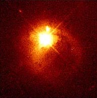
Example of a quasar 1.5 billion light years from earth. This quasar is so bright that it created diffraction spikes on the telescope image. Photograph courtesy Hubble Space Telescope (HStsci).
September 7, 2002 Charlottesville, Virginia - A billion light years from earth there is a very bright quasar known as JO841+1842. Quasars give off enormous energy from great distances. Tomorrow, Sunday, September 8, Jupiter in our solar system will pass very close to the light's path from that quasar.
Click here to subscribe and get instant access to read this report.
Click here to check your existing subscription status.
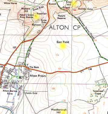
The large East Field in Wiltshire, England spreads out below Adam's Grave and Knap Hill. Across the road to the south is Woodborough Hill and Tawsmead Copse. Since the modern crop formation phenomenon began in 1989, this geography has become legendary for mysterious lights and interactions with helicopters.
September 1, 2002 East Field, Wiltshire, England - Two weeks ago on August 14th was my last day in England. A new crop formation had been reported in the famous East Field below Adam's Grave and Knap Hill to the north and across the road from Woodborough Hill and Tawsmead Copse to the south. As I walked toward the formation, I took a photograph with Woodborough Hill in the background.
Click here to subscribe and get instant access to read this report.
Click here to check your existing subscription status.
August 31, 2002 Washington, New Jersey - Earlier this summer, I met a New Jersey man named Riley Martin who in 1995 wrote a book entitled, The Coming of Tan. Tan is the name of a non-human being from what Riley understands to be a planet called "Biaveh" 450 light years from earth in the Taurus constellation that also contains the Pleiades. Taurus (The Bull) is northwest of the Orion constellation.
Click here to subscribe and get instant access to read this report.
Click here to check your existing subscription status.
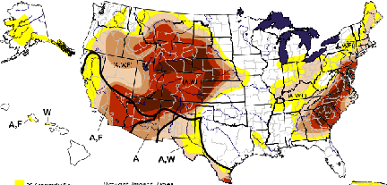
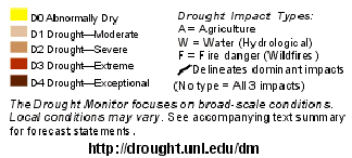
August 20, 2002 map prepared by the National Drought Mitigation Center at the University of Nebraska in Lincoln, Nebraska. Thirty-seven states as of August 20, 2002 are experiencing abnormally dry to exceptionally severe drought. In July 2002, all continental states had areas of drought for the first time since the National Drought Monitor began its maps in 1999.
August 27, 2002 - This week in Johannesburg, South Africa, the largest United Nations Earth Summit ever convened is focused on how to sustain our deteriorating planet's environment. World leaders, including Tony Blair from Britain, will attend next week, but not the American president, George W. Bush. Not only is the United States government unwilling to participate with the other countries in setting timetables to cut back pollution and greenhouse gases, the specific words "global warming" are not even listed on the program's agenda of problems to be discussed, clearly someone's political decision.
Click here to subscribe and get instant access to read this report.
Click here to check your existing subscription status.
August 24, 2002 Vancouver, British Columbia, Canada - Paul Anderson, Director of the Canadian Crop Circle Research Network, (see website below) is reporting six patterned crop formations since July 23rd.
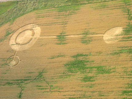
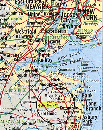
August 24, 2002 Colt's Neck, New Jersey - On Thursday, August 22, I drove to central New Jersey into the beautiful horse and farm community of Colt's Neck. At one end of Dorbrook Park running along a forest of deciduous trees is a rye field rented by a farmer from the township. On August 15, Colt's Neck residents reported a large crop formation in the rye.
Michael Glickman and The Crop Circle Connector with many others have
contributed towards a fund to ask the farmer to keep the crop Circle in the
field until after the UK Bank Holiday 27th August 2002. We would like to
thank the farmer and the contributors for this gesture and hope many more
people will visit the crop circle in the next few days."
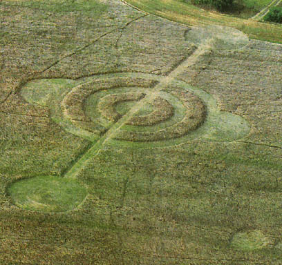
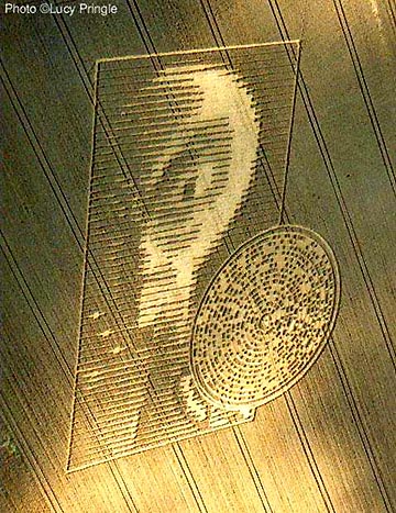
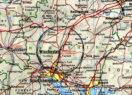
August 22, 2002 Pitt near Winchester, Hampshire, U. K.
Please see the following e-mail responses to ongoing discussion about the August 15, 2002 formation on the Vale Farm bordered by the Crabwood copse in the village of Pitt east of Winchester, Hampshire, England.
Update on August 19, 2002 - The following is the Sunday, August 18, 2002 E-mail I received from Earthfiles viewer who described himself as: "A large part of my full time job is decoding ciphers and reverse enginereering communication protocols." His original text below is updated with additional notes about the bell ringing sound. (He requested anonymity and later gave his name as Richard Brain.)
Click here to subscribe and get instant access to read this report.
Click here to check your existing subscription status.